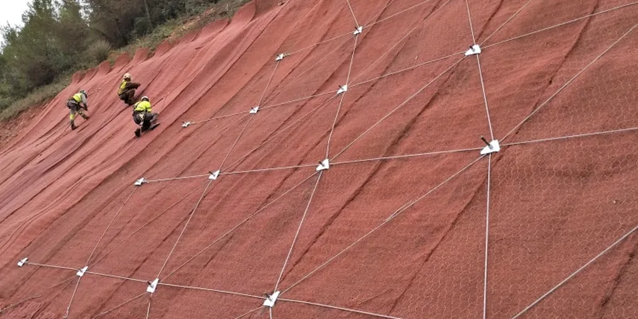
Wexford’s expansion from its medieval Norse core onto the surrounding drumlins and glacial till slopes has created a patchwork of development sites where ground stability cannot be taken for granted. The quay front and the land rising toward Ferrybank conceal complex sequences of Irish Sea till, glaciofluvial sands, and weathered shale bedrock. A desk study alone misses what a proper slope stability analysis reveals: perched water tables, relic shear surfaces, and sensitivity to construction pore pressures. The county council’s development plan increasingly requires site-specific geotechnical justification for earthworks on gradients exceeding 1:5, particularly within the Wexford town boundary where surface water drainage is already constrained. We combine rotary-cored boreholes with inclinometer installations to measure actual slope movements, feeding data directly into limit-equilibrium models calibrated with laboratory shear strength parameters. For shallow failures in boulder clay, the test pits programme provides direct observation of the weathered crust thickness and groundwater seepage patterns that control Factor of Safety calculations.
A 1-metre rise in perched groundwater can reduce the Factor of Safety on a 25° till slope by more than 30% — Wexford’s winter water table is the critical design case.
Applicable standards
I.S. EN 1997-1:2004 + Irish National Annex (Eurocode 7: Geotechnical design), I.S. EN 1997-2:2007 (Ground investigation and testing), I.S. EN 1998-5:2005 (Eurocode 8 – seismic geotechnical design, Irish low-seismicity parameters), CIRIA C580 (Embedded retaining walls – guidance for tie-back and anchor design where applicable), Transport Infrastructure Ireland (TII) – Earthworks and drainage design for road embankments
Frequently asked questions
When does a Wexford development site need a formal slope stability analysis?
Wexford County Council typically requires a slope stability assessment when cut or fill slopes exceed 2.5 metres in height on gradients steeper than 1:3, or when the development is within a zone mapped as having a history of landsliding. Even outside these triggers, a prudent designer commissions an analysis whenever the Factor of Safety could fall below 1.30 under worst-case groundwater conditions. The assessment protects the planning application from later requests for further information.
What soil parameters are most critical for Wexford’s glacial tills?
The effective cohesion intercept (c’) and the effective friction angle (φ’) at both peak and residual states govern the outcome. Wexford’s Irish Sea tills often show c’ values of 0–5 kPa and φ’ peak around 30–34°, but the residual φ’ can drop below 26° on pre-existing shear surfaces. We determine these through consolidated-undrained triaxial tests with pore pressure measurement and ring shear tests on the clay fraction.
What does a slope stability analysis in Wexford cost?
Budget between €1,240 and €4,030 for a complete site-specific analysis, depending on the slope height, the number of boreholes and laboratory tests required, and whether 3D back-analysis is needed. A small single-plot assessment with one borehole and limit-equilibrium modelling sits at the lower end; a multi-slope commercial development with instrumentation and FEM verification occupies the upper range.